GR54: Rematch

GR54: Rematch

Planning has started for the long awaited (at least by me) rematch with the GR54.  After it kicked my arse last year I intend to be better prepared in terms of hill fitness, food and equipment.  A reminder of the route is below.  I arrive in Lyon on the evening of the 12th of June and fly back on the evening of the 17th.  I have four full days available to me on the trail to do what needs to be done.  At this stage I’m planning on it taking 3.5 days.


Over the coming months i’ll keep you updated on training, equipment and the food tasting sessions that i’m particularly looking forward to.

mm

Callum is an engineering geologist with a love of the great outdoors and physical challenges in extreme environments.

The Cotswold Way Century

The Cotswold Way Century

The ultimate challenge of ultra running for me is the 100 miler.  An unfeasibly long way that just seems way beyond what anyone should try and run.  After the Marathon Des Sables in April and the trip to the Alps in June it was time for the next challenge.

The Cotswold Way goes along the Cotswolds Hills from Chipping Camden in the North to Bath in the South hitting just about every hill and ridge and every valley bottom and picturesque village on the way.  The event is run by Kurt of Cotswold Running along with a string of other events in and around the Cotswolds such as the Broadway Marathon and Naunton nearly 19.

The race started at midday on Saturday the 22nd September after a journey by train and bus from Oxford.   A thing that didn’t quite sink in completely until shortly before the race was that this would require running throughout the night.  I was aiming initially (a little optimistically) for between 20 and 24 hours.  For this I had taken my 50 mile time, multiplied it by two then added a little more.

Things didn’t look good for the race in terms of weather.  Autumn seemed to have decided that this would be the weekend to make its appearance.  This combined with the tail end of the hurricanes coming across the Atlantic didn’t help.  The forecast was for rain, wind and cloud and it didn’t disappoint.

In terms of gear I kept it fairly simple – I wore the Altra Olympus trainers with Injinji wool socks and another pair of Darn Tough low wool socks, underarmour compression heat shorts with some regular shorts over the top, I wore my adidas coolmax long sleeved shirt (the same as for the MdS) and the Outdoor Research cap.  There is some compulsory gear to carry such as a spare long sleeved top, waterproof jacket, hat/buff and some emergency gear.

We started in the rain and progressed up the first slopes trying to keep it nice and slow but still not wanting to get behind too may people.  I had a plan to keep well on top of my hydration and keep eating as I progressed.  I was mostly carrying real food like oatcakes and pretzels with a few shot bloks and some kendal mint cake.  I wanted to stay away from too much sugar until I got well into the race.  Things were nice and steady in the beginning just plodding along as we went towards Broadway Tower and then descended down to the village of Broadway.  I remembered this section of the route from the marathon the previous November so was familiar with this part of the route.

From here the rain came on again and the cloud started to come down.  I mostly ran by myself just keeping the pace steady and enjoying the surroundings.  It must have been about 40 miles in when the light started to fade and I passed by what must be an prehistoric fort or settlement.  I descended from here and recognised a face from a previous Cotswold running event – he had won the marathon and set the record for the Century the year before – Rob Forbes.  I ran with him a bit before he took off for the next checkpoint  – he was helping out and not competing this year.  I arrived at the checkpoint got some help topping up with water and got the first of a series of cups of tea throughout the race that made a huge difference.

From here it was head torch territory as I entered the woods and went back and forth along what seemed to be zig zagging paths finding it hard to get any feel for direction.  As the night closed in the race was pretty much a series of paths and track through the woods with people occasionally passing and me occasionally passing someone.  The halfway stop was very welcome particularly the veggie chilli and more tea!  it was good to get some shelter and recharge a little.

It must have been almost mile 60 when the temperature dropped and the wind and the rain came in again, it was particularly difficult to see with the low cloud reflecting all the light of your head torch back into your face.  Thankfully voices carried into the dark and I homed in on a tent with a welcome stove and cheerful faces.  Another cup of tea and some Pringles and I wanted to get going again – no point waiting to seize up.  Back into the woods and I headed towards the notorious golf course where the trail basically does a 3 mile loop.  I met up with a lady here who was familiar with the course and had a garmin etrex to help with the route.  I relied absolutely on her for this part of the course so thank you!  We went onto the next checkpoint relieved to be out of the cold and to have another cup of tea and some spaghetti O’s.

As we did time calculations I was not happy with how long this was looking like taking.  The final time wasn’t so much the problem – more the fact that I didn’t want to be on my feet pushing at the final cut off and then still having to get the train home.  I decided to push on and increase the pace as the first morning light came in.  It was a relief but it didn’t bring much warmth, instead we got more rain and wind.  At this point I donned my extra layer to try and keep the cold off and kept moving – by this point your pretty drained and constant rain and wind had sapped a lot of my energy – hypothermia wasn’t far away in conditions like these.

It’s probably a good time to dispel some myths about ultra “running”.  When the majority of people say the they run an ultra marathon what they really mean to say is that they ran and walked an ultra marathon.  A significant amount of time and the distance is done walking or shuffling along.  It’s generally only the top people who run the whole or majority of the way – so don’t feel bad if you need to walk – it’s essential in order to complete it for most people!

The last 25 miles or so were not really that notable.  The people who knew how to pace a race of this length started to go by and my legs started to progressively get harder to move.  On the plus side the rain stopped and it finally started to warm up.  The sun came out for the last 15 miles and I even ended up a bit sun scorched by the end.  I walked it in for the last 10 or so miles soaking up the views of Bath and the surrounding countryside.  I even took time to read the signs at the site of a Civil War battlefield.  From here I walked passed by the race course and continued on down to Bath where I though it would be a straight route down to the centre.  Unfortunately I think the official route planners needed to make up some extra distance on the cotswold way by the time they got to Bath so the route goes up and down a few hills on the outskirts of Bath before finally taking you into the centre and past the grand old buildings.

The very last stage takes you into the very centre of the city to the Cathedral.  By this point I was having a nice stroll – no real desire to push the pace.  I was happy to be getting to the end of this endeavour and having achieved the “big one” of ultra distance running.

I rounded the corner for the last approach to the cathedral, broke into a trot and was happy to be done with it.  What a slog! 102 miles in 26 hrs 46 minutes

I’ve achieved all I want to in terms of running goals for the foreseeable future.  Bring on the light hikes with flask of tea and some sandwiches!

mm

Callum is an engineering geologist with a love of the great outdoors and physical challenges in extreme environments.

The Tour de Oisans (GR54) and other adventures

The Tour de Oisans (GR54) and other adventures

A few colleagues were heading to the cycling mecca of Bourg de Oisans in the French Alps, home to Alpe d’huez and close to other famous cycling climbs such as Col du Galibier and Col de la Croix de Fer as well as the notorious La Marmotte route.  Not being much of cyclist I looked into what else was around – enter the GR54 or Tour de Oisans.

The GR54 is one of the great long distance walking trails in France known as the GR’s or Grand Randonees. They exist across the country with the most impressive being in the Alps, Pyrenees and, a personal favourite of mine, Corsica.  The GR54 goes around the L’Oisans region in the French Alps circling the high Oisans and Ecrins massifs with the start and finish in Bourg de Oisans.  The complete route is approximately 100 miles with, in the region on 11000m elevation gain and lost.

We flew into Lyon Saint-Exupéry airport on a Thursday afternoon with the return flight scheduled for Monday mid-afternoon giving a full 3 days to complete the route.  With the 50 miler and MdS experience I figured I could push out the 30 odd miles a day needed to complete the route and possibly even finish in two and half days.  Then I started…

It was about 5:45 when I set off from the village of Oz to get to the start point in Bourg de Oisans. Thankfully a friend had been coerced into giving me a lift to the start point to help me on my way rather than having to walk the extra few miles.  As described in the guidebook the start is a strange place where you are greeted by signs telling you not to urinate.  You quickly pass by these and straight into the climb up the stepped cliff face then passing through deciduous woods before climbing higher up towards the mountain village of La Garde and skirting the other side of the valley from Alp d’Huez. Following the Sarenne River you come into a ski area with a Via Ferrata to the left side and continue climbing up the valley ahead.  The summit is the col du Sarenne with great views to Le Meije and the Oisans Massif. It was still overcast for this first section of the route with the sun starting to make an appearance as I summited the col.  Things were going well up these initial climbs, making good progress.

The decent from Col du Sarenne is hard going.  After following a few switchbacks on the road you descend via a rocky footpath towards the village of Clavans le Haut and continue down towards a river crossing via the road bridge before the short and sharp climb up to Besse. Besse is a very picturesque mountain village with the characteristic stone and wood houses with the main living area above the old barn area below.  The initial climb out of Besse follows the road towards the east before joining a footpath with zig zags up the grassy slopes.

The highest parts of the route in this section are the two col’s either side of the Plateau d’Emparis, which is a beautiful grassy area on a high plateau.  This was a highlight and I could see how later in the summer it would be really nice to have spent more time here at one of the refuges overlooking Le Meije and the Romanche.  This part of the route, though the most pretty, also sucked the energy out of me. The climbing was hard and continuous but the higher altitude and resultant exposure to the sun was the real killer.  I could feel the sun starting to sizzle my right side (it’s always my right side! – see SDW50 post).  Saying goodbye to the Plateau d’Emparis I started the long descent towards La Grave taking in some smaller villages and a combination of rocky tracks and tarmac roads. Entering La Grave I could tell the sun had seriously taken its toll so I stopped and rested a while and contemplated the plan.  Initially I had hoped to get close to Vallouise on the first day – setting me up for the two more challenging days in the south.  Though it was still only mid afternoon I couldn’t see this happening now.

Feeling pretty weak and overheated I carried on out of La Grave heading for the woods and the exceptional walk alongside the Romanche.  This section is a remarkable walk along the river with wildflowers and shrub vegetation.  After a while the river swings to the southeast and I started to climb up towards what eventually would be the col d’Arsine.  The valley closes in during this section with high cliffs and valleys on either side.  This had a true mountain feel to it and a taster of what the rest of the route would be like.

I decided to set up my camp for the night after the first significant climb towards col d’Arsine. It was good to be out of the sun and cooling down.  I could feel the burn on my arms and the effect of the heat during the day and decided I wasn’t going to push on any further and would head back towards Bourg and Oz the next day.  At the pace and condition I was in I wouldn’t be able to commit to the route beyond Vallouise, after which there are few viable ‘outs’ that would enable me to catch the flight.

Mt first attempt at the GR54 ends in failure.  I will be back next year better prepared for the sun, the heat and the route.  I have already booked my flights for the second round!

One benefit of not hammering the rest of the route was that I was able to have one of the best day hikes I have had in a long time.  The route starts approx. 13km to the north of Oz past the village of Le Rivier d’Allemont. The start is conspicuous due to a large landslide in the 1980’s that blocked the road and led to the rerouting of the main road further down the valley.

From the start you follow the river and a sequence of waterfalls up a long and steep climb to get onto the plateau.  There are a few river crossings and plenty of loose rocks on the footpath.  I also got to spot a few Ibex as I came to the top of the climb.  The plateau then opens up to a view of lakes and snow fields.  The snow was soft and wet which gave some difficulties in skirting the steep slopes around the lakes but was all good fun.  I pressed on over the high point of the walk and descended slightly to the refuge des 7 Laux.  Some very friendly Frenchmen offered me swig of Rosé and then I took off, retracing my steps across the snow fields, skirting the lakes and back down the steep path along side the waterfalls.  At the end of the footpath I descended further onto the road, following the new section to the bottom of the valley.

From here the terrain and the vegetation changed completely.  I went from a high Alpine world to one of mixed woodland along the steep valley side.  This seemed to be part of a very old trail network linking places at either ends of the valley.  Largely disused, there were fallen trees and deep leaf litter along most of the path. After the hard rocky trails it was a pleasure bounce along this winding path.  Eventually, I emerged in the villages at the southern end of the valley and headed back to Oz satisfied that even though I’d missed out on completing the GR54 this time I had had one of the best days in the mountains.

mm

Callum is an engineering geologist with a love of the great outdoors and physical challenges in extreme environments.

Marathon Des Sables 2018 Kit List – Clothing & Gear Review!

Marathon Des Sables 2018 Kit List – Clothing & Gear Review!

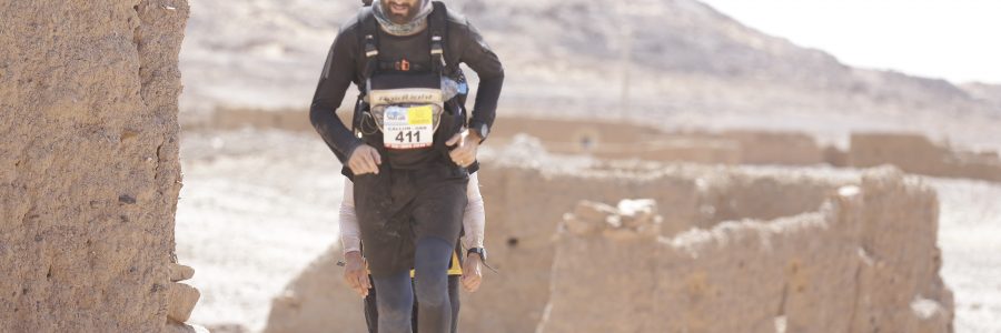
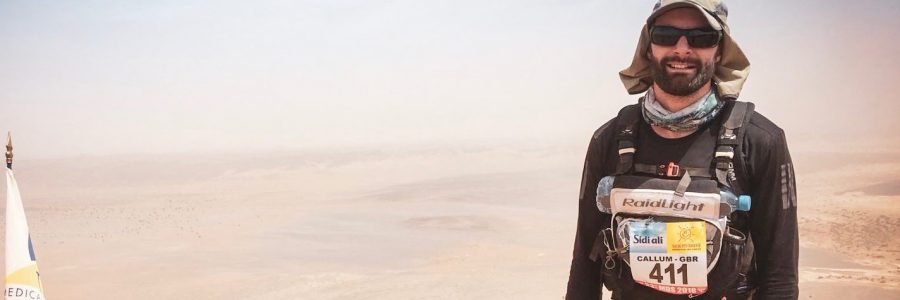
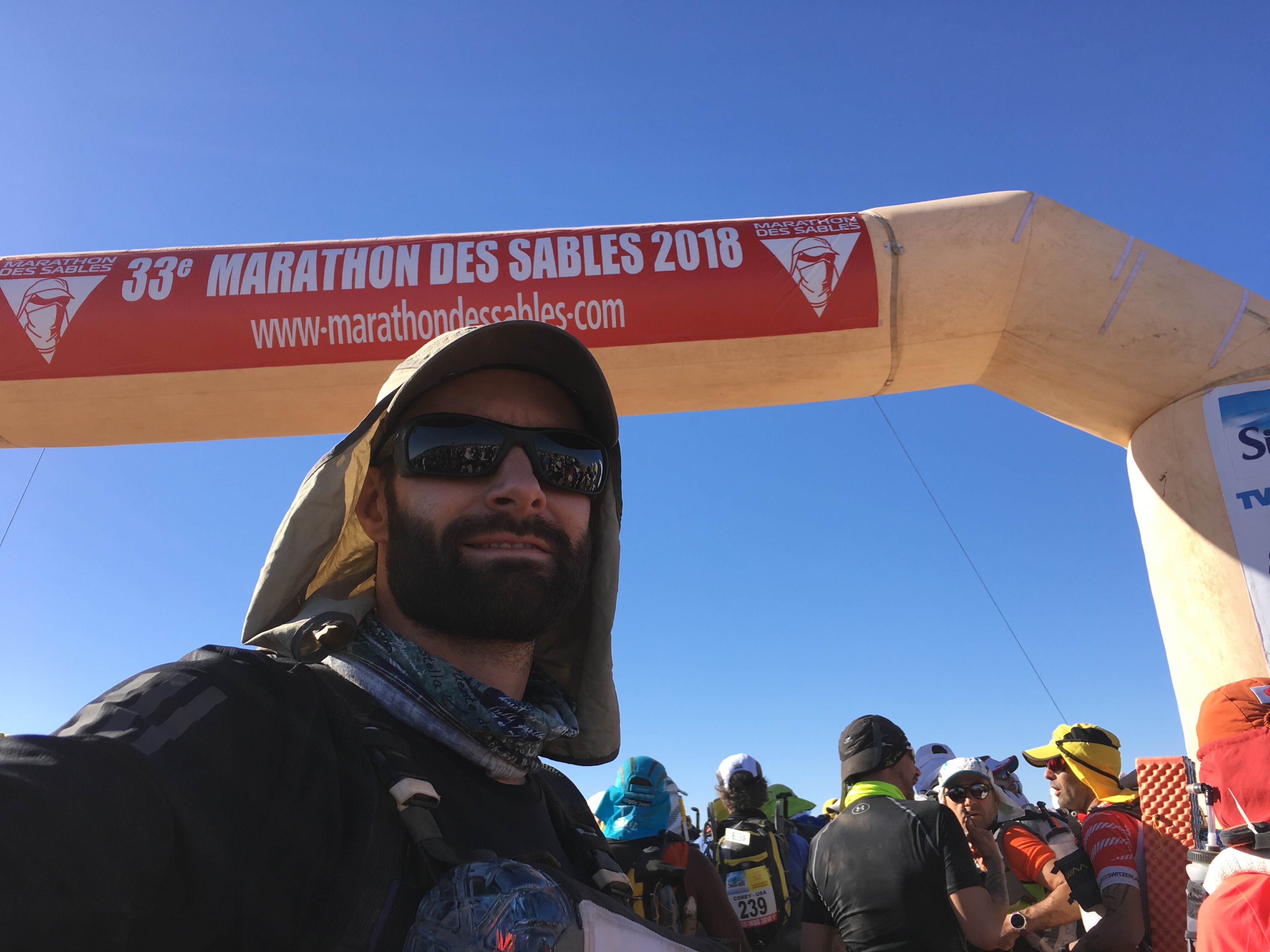
The gear you choose takes up a lot of time and may or may not make a huge difference in how you do during the Marathon Des Sables.  I’m going to go through my kit list, gear and clothing choices and let you know how I got on.

Kit List: Clothing:

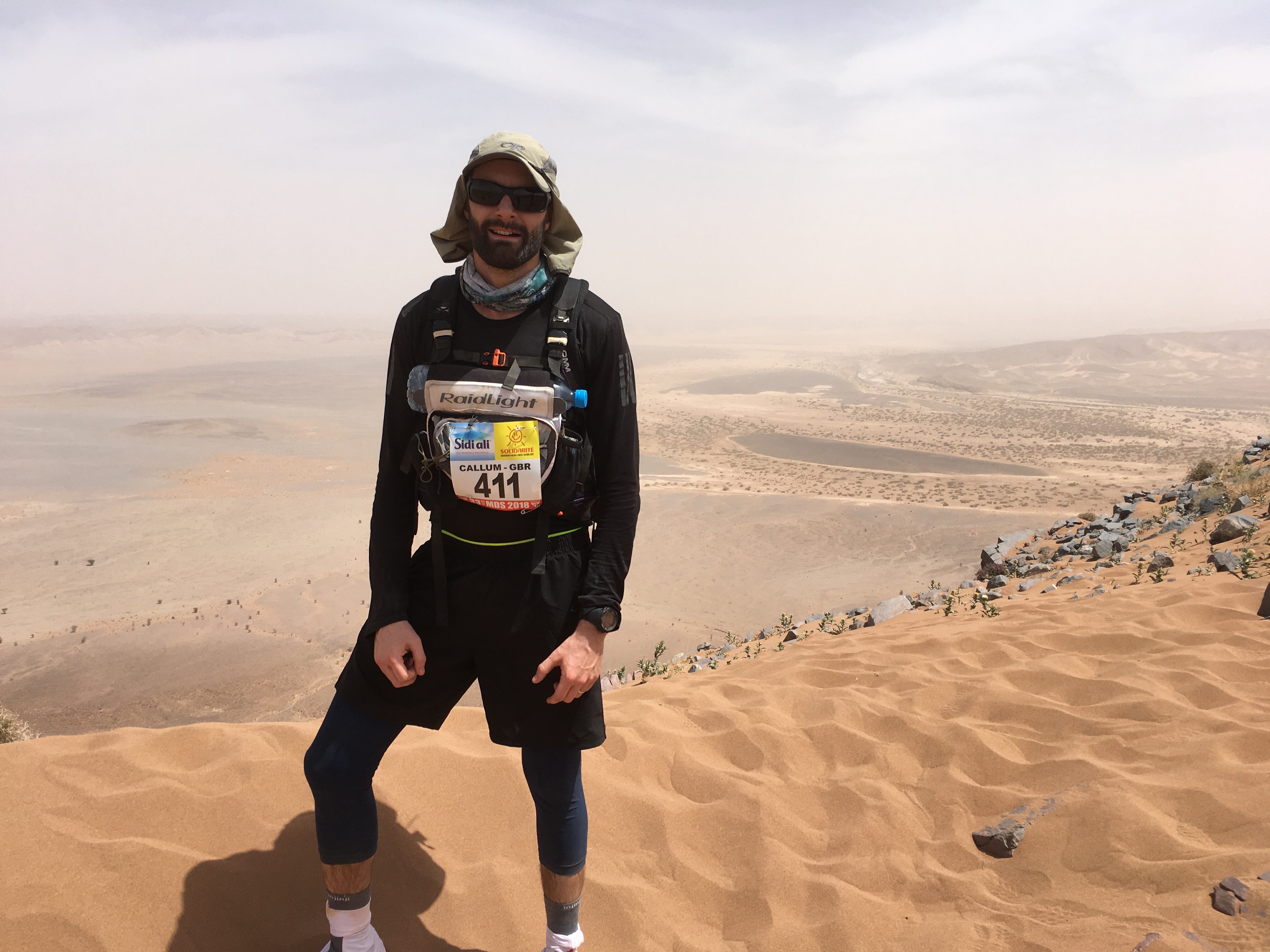
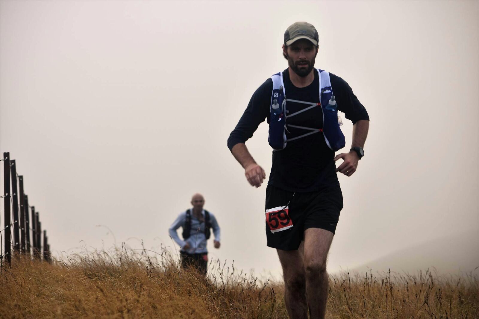
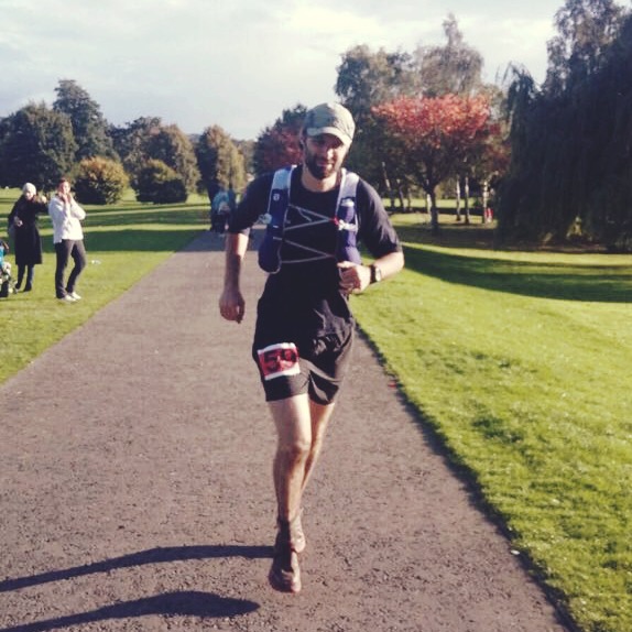
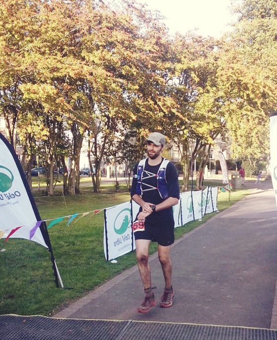
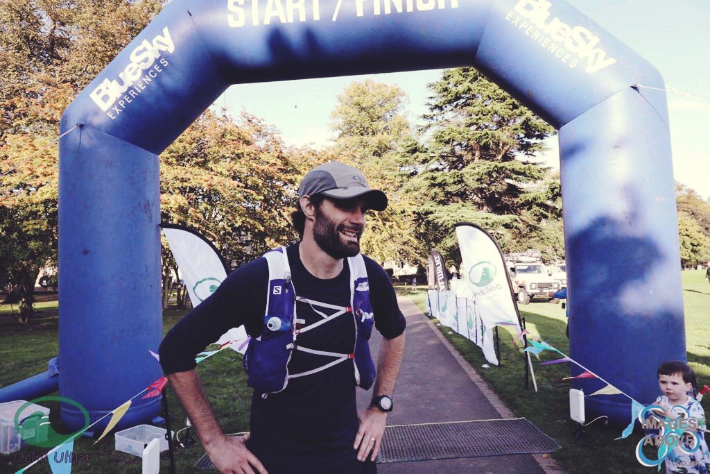
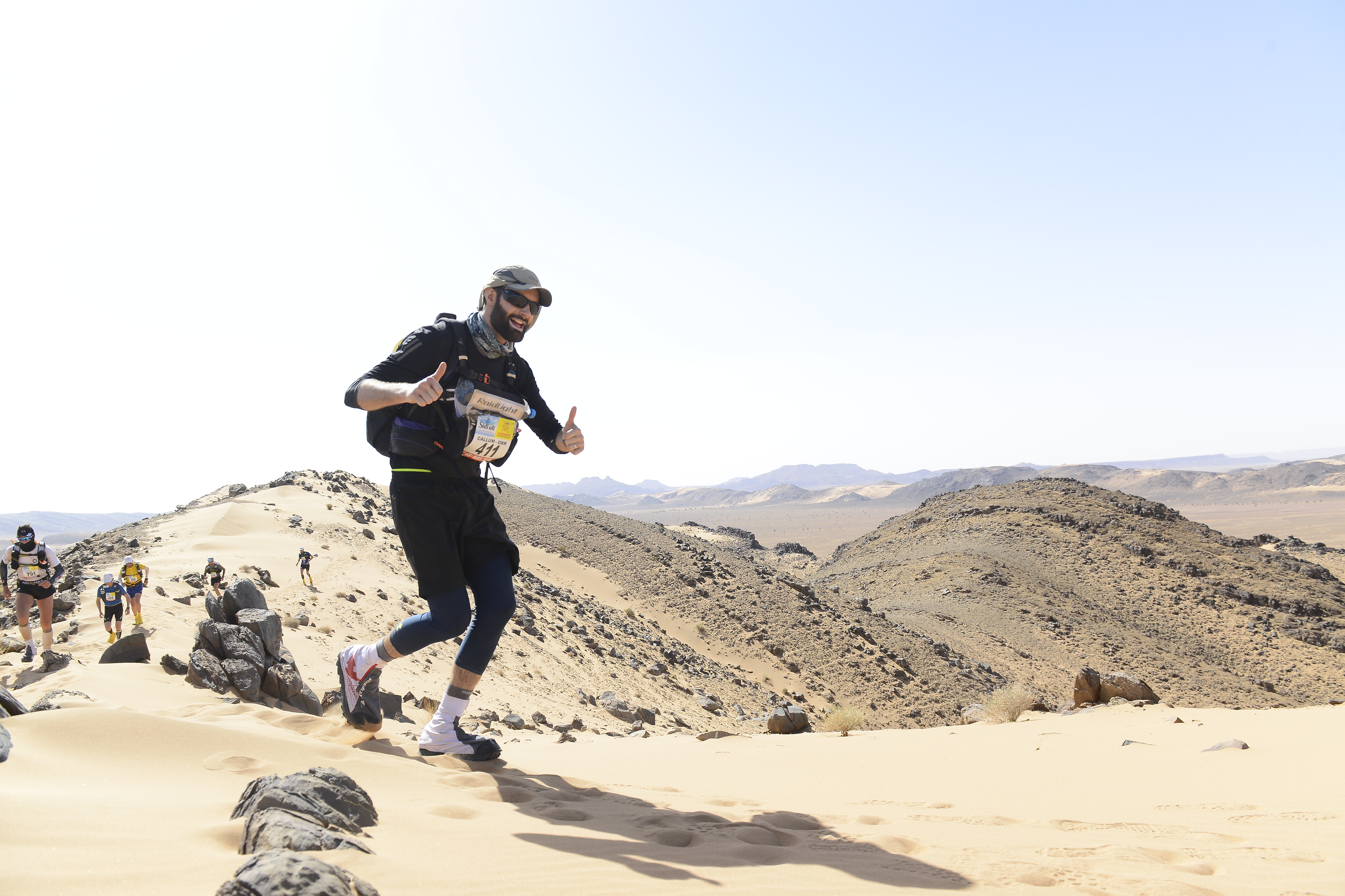
I left the clothing choice until quite late in the day, as I could never really make my mind up. Everything said to take compression shirt and shorts but I’ve never really liked compression gear for running. In the end my priority was skin coverage and something that wasn’t too tight or too billowy.  I went for an Adidas response long sleeved t-shirt (Adidas Shirt) and shorts (Adidas Shorts), both made of climacool material that may or may not have kept me cooler (who knows!).  Both performed really well but the label placement on the inside from seam of the shirt doesn’t help when your wearing a rucksack waist belt.

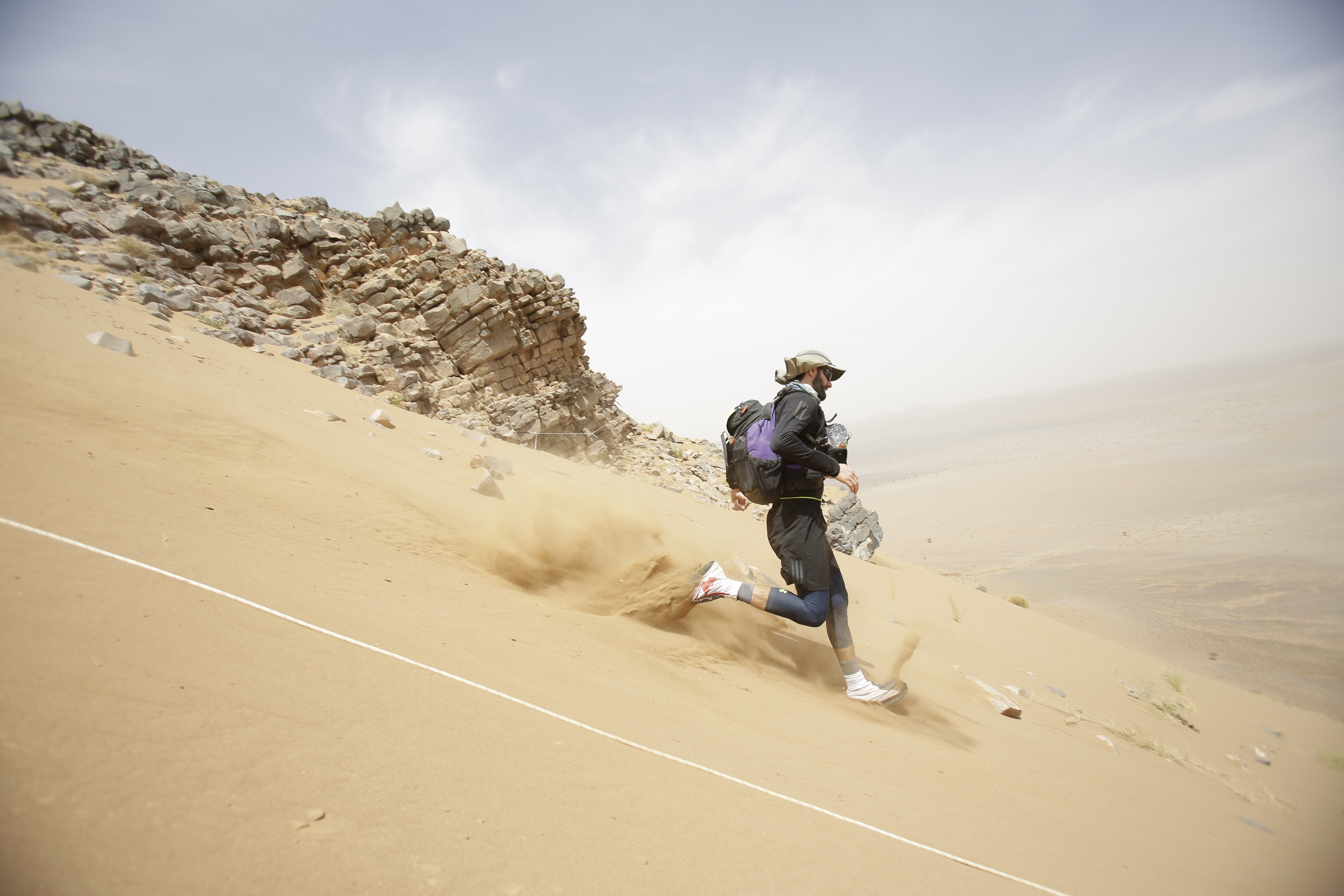
To get the skin coverage I also wore some UnderArmour Heatgear ¾ leggings (Leggings).  This was really out of fear of sunburned legs (note my first post on the blog).  These were great and I didn’t get overheated in them. If was to do it again (I have no plans to) I would leave the leggings and just make sure to use some good sunscreen. It would be nice to have a bit more air circulation.

I went with a two sock approach the first were some injinji merino liner socks (Injinji Liner).  These were great and prevented my toes from rubbing together. On top of these I wore some Darn Tough Merino ankle socks (Darn Tough Low).

Finally on the clothing front I wore a pair of Altra Lone Peak trainers.  Altra make some great trail running shoes.  Altra shoes are all zero drop (same height at the heel and toe but have a good amount of cushioning in the sole.  I was deliberating between the Olympus or the Lone peak but the thinner sole (compared to the Olympus, but by no means thin) of the Lone Peak won out for the MDS (Altra Lone Peak 3.5).  The shoes proved to be really hard wearing with no wear on the sole, which is saying something considering I saw other people’s trainers falling apart with chunks missing out of the soles.  The Altras also have a big “foot shaped” toes box that gives loads of room for your toes to spread out.  I had some blisters on the outside edges of my toes during the race but I think part of this is down to the velcro and Raidlight Desert Gaiter  which changes the shoe shape slightly and seems to pull the trainer up more, putting more tension on the toes.

For the evenings I also had a Uniqlo down jacket (Uniqlo down jacket) that was super light and cheap.  It gave the perfect amount of insulation for the evenings and extra warmth at night.


Kit List: Gear

I had an Outdoor Research sun runner hat (Outdoor Research hat).  This was a really great piece of kit that I wore non-stop. I wore the full thing with the Foreign Legion style sun sheet the whole time except for the early part of the last day when it was overcast and not too bright.  I would recommend this to everyone.  The sheet is detachable so can be adapted to your needs.

I also wore a pair of Julbo Bivouac glasses with the photo-chromatic and polarised chameleon lenses.  These were solid and I had no problems with them.

Going for full sun protection I also went for a sun protection Peregrino Buff which also came in handy as a hat when the sandstorm came in and it got chilly at night.

I used my Suunto Ambit3 Peak and HR monitor for the whole race using an ultra setting I created by reducing the GPS accuracy to the ‘OK’ setting.  This gave ample battery life to run the GPS during the races and as a regular watch until I got home.  I was a bit worried about wearing the chest HR monitor under the rest of the straps i’d need for the rucksack and front pouch but it worked fine.

A lot of people went for the MdS rucksack that we got at the expo with varying results – most not great. I went for the Classic OMM 25 Litre pack which I bought before I knew we were getting a free one.  This turned out to work really well.  It’s a simple construction with a large main compartment, zip pocket on the lid and mesh pockets on the side, the back and the top.  I could also fit the Raidlight front pouch to this rucksack fairly easily whereas this wouldn’t have been an option for the MdS pack.

The Raidlight front pouch made a big difference for me and allowed me to have food and water readily available.  I didn’t use any extra water bottles and just took the plastic 1.5L ones were given and carried them in the Raidlight neoprene tube on the top of the front pouch.  This saved a lot of faffing about at the checkpoints, however if you were going for calories you need to mix into your water bottles then this wouldn’t be a good option for you.

Kit List: Camping Gear

Firstly the sleeping bag. I wanted to go light on this front but there are usually some scare stories about it getting cold.  The Nordisk Oscar +10 really well with the Rab silk sleeping bag liner.  I used the fold out half length matt that comes as the back stiffener in the OMM pack to sleep on – not the most comfortable but it did the job.

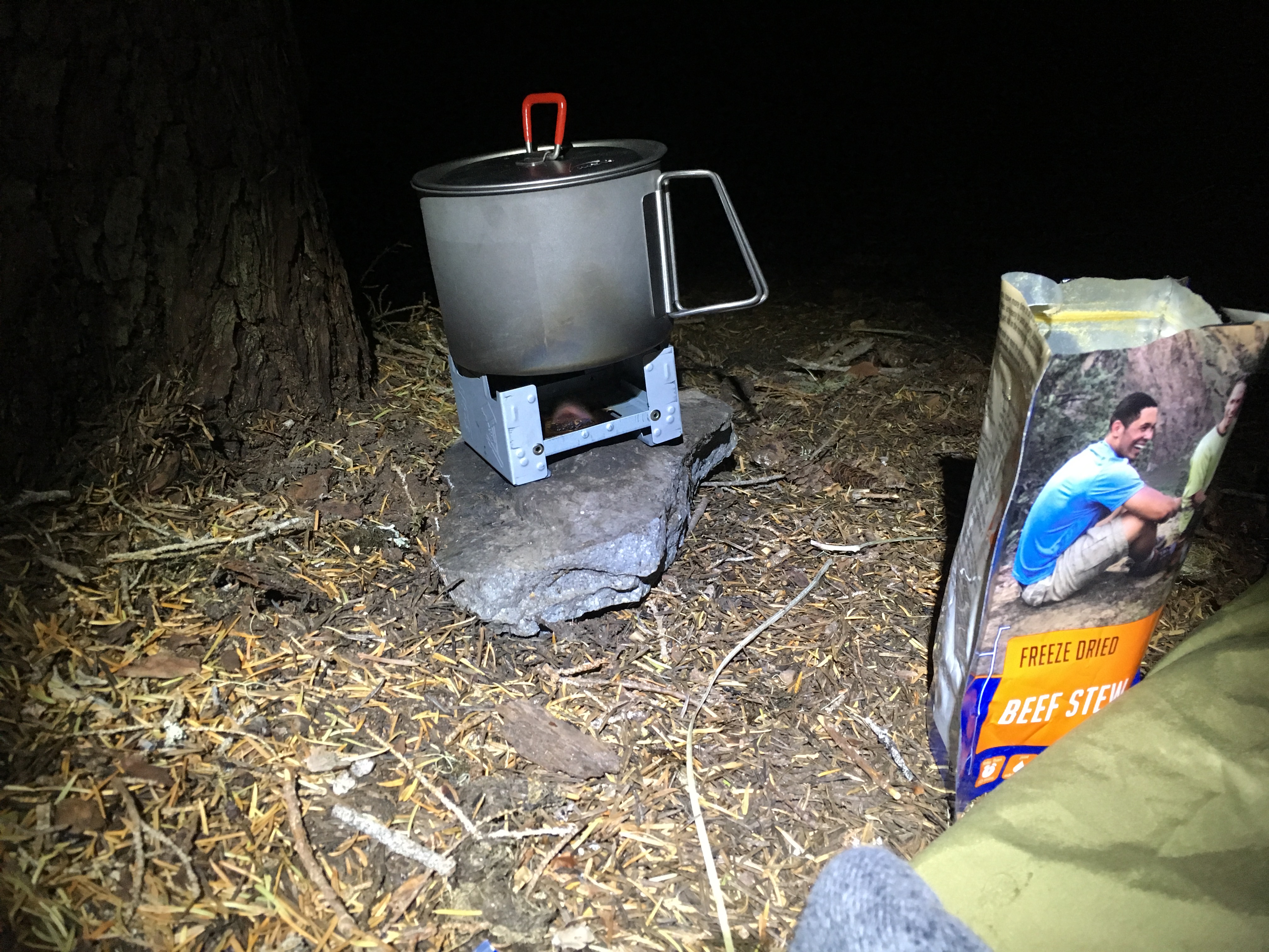
For cooking I used the MSR Titanium kettle with the Esbit titanium stove.  These worked really well and I liked the larger capacity of the MSR kettle (0.85L).  The best piece of kit for cooking was the titanium wind shield I got from Amazon (I’m not sure who actually makes them).  This was amazingly light and made a huge difference in the efficiency of the fuel tablets.  It rustles a fair bit but otherwise is excellent.

In general for food I would recommend the expedition foods 250km desert race nutrition pack.  This takes the fuss out of preparing the food. I added a few more snacks and some extra recovery powder but that was about it.  I would probably add more shot bloc type stuff to this as a ran out of energy for the last day and could have done with more ready carbs rather than carrying pretty much useless macadamia nuts (thought the Kcal to gram ratio is great they don’t help you out in the middle of a race as you need ready sugars and not fat).

I decanted all the Exped. foods rations into zip-lock bags to save some extra weight – I’m not sure how much difference this made but it worked well and didn’t cause any problems.

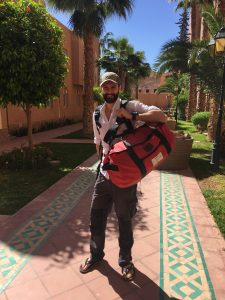
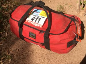
As well as the gear I used during the race it’s worth mentioning the bags I used to get me and my kit list to the start line.  I’ve used kit bags from Montrose Rope and Sail Company for many years working offshore.  These are great, hardwearing and inexpensive kit bags that rival your North Face duffels.

montrose rope and sail company duffel bagmontrose rope and sail company duffel bag

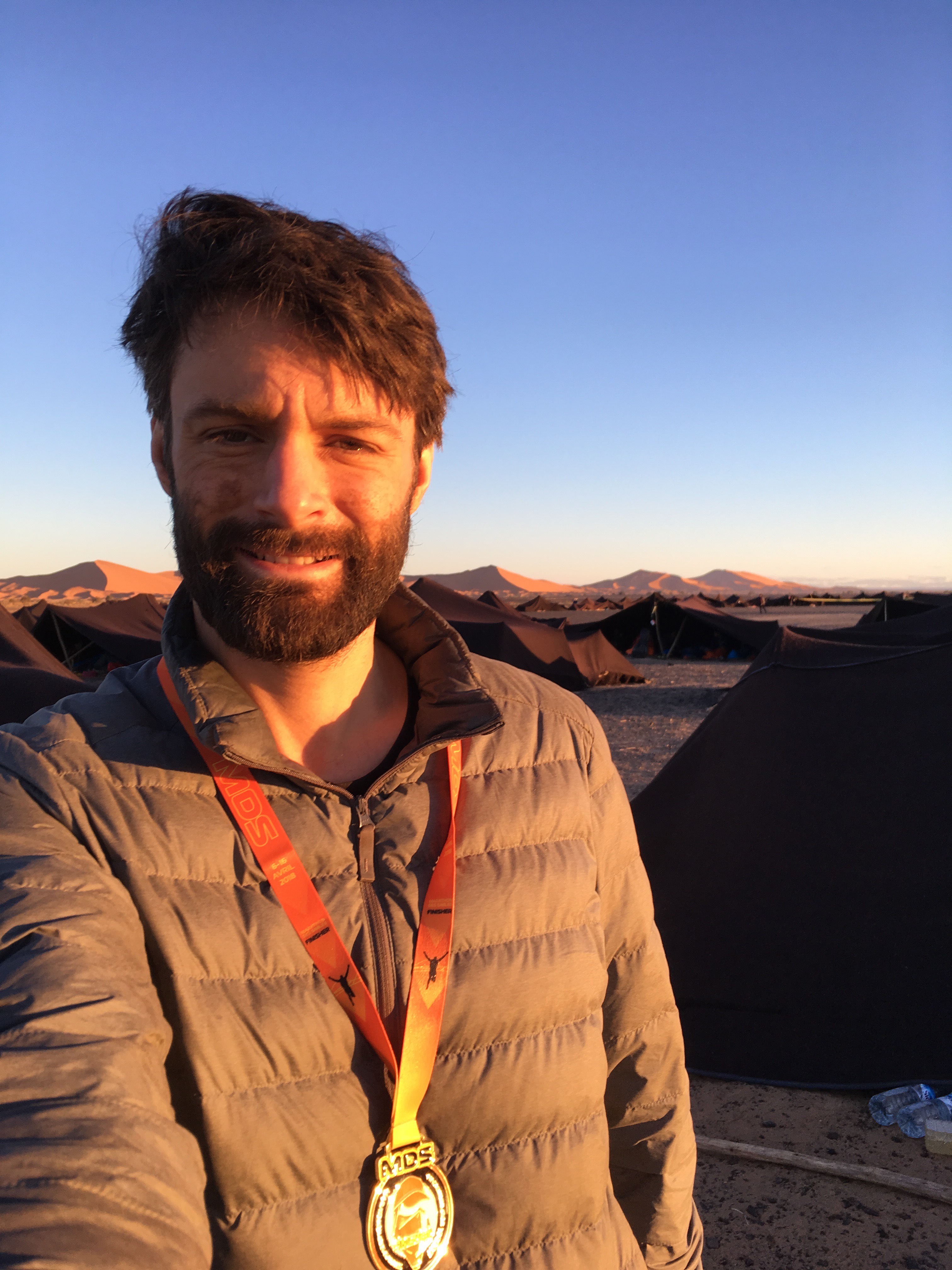
All in all my clothing and gear worked well.  I had a sun-burn phobia which kept me covered up, in the future I wouldn’t go so far with the coverage and allow myself to come back with a bit of a tan.  Other than that I don’t think I would change very much.  The biggest winners  in the kit list were the Outdoor Research hat, Raidlight front pouch, Uniqlo down jacket and the titanium wind shield.

marathon des sables weeventure


mm

Callum is an engineering geologist with a love of the great outdoors and physical challenges in extreme environments.

Return from Morocco // Initial reflections on the Marathon des Sables 2018

Return from Morocco // Initial reflections on the Marathon des Sables 2018

Thanks to everyone for all your support while I was away running the Marathon Des Sables. It was a great adventure and challenge. I was astounded to see so much interest and so many messages from people spanning my whole life from days in Germany to Harris Academy, St Andrews and now Oxford/London. The support was much appreciated and meant a lot when the printed notes were brought round to the tents in the evenings.

I met some great people while I was in Morocco both civilian, current and ex military (regular and reserves). In my tent alone we had backgrounds as varied as an ex-professional pianist turned entertainment lawyer, a Chinook pilot, two Royal Marine Reserves, an entrepreneur, structural engineer and wealth manager – What a mix!

The week had its ups and down and challenges, not only the fitness associated with the races themselves but also the general upkeep of you body to make sure you could get to the start line each morning. Most important was hydrating and refuelling after each race but also making sure you got enough rest and sleep in an environment that is often not very conducive to it!

I had a fantastic result for the week placing 58th overall. The race had its ups and downs with the hardest point for me being the last race day. I could feel that I had very little left in my legs as we set off across the dunes for the final marathon distance but despite eating everything I had to hand there was no powering up the legs again. It was a struggle for the last 25km into a powerful and persistent headwind that seemed determined to slow me to a walk. It was a relief to finish that day and know that the competition was over.

The two highest points of the week were day three, the Jebel day, and starting the long stage as one of the top 50 athletes. The Jebel day was incredible – running along the rock ridges with steep climbs and fast descents. The experience of starting the long stage among the top 50 was something special. I’d seen the documentaries of the MdS showing the top 50 “elite” athletes starting the long stage and it was amazing to me that I was there starting the long stage 3 hours behind the main pack ready to try and pass through the other runners on the way to the finish

The MdS was a great experience – a fantastic adventure. Very challenging at times but well worth the effort.


mm

Callum is an engineering geologist with a love of the great outdoors and physical challenges in extreme environments.

The Ochil Ultra 50 – Pain Again

The Ochil Ultra 50 – Pain Again

After the South Downs Way 50 in April I thought I’d have another go at a 50 miler in preparation for the MDS 2018  – the Ochil Ultra. This time I’d avoid the scorching sun of the south coast (strange considering I’m training for a desert marathon) and opt for a nice grey day in Scotland in late September.

The inaugural Ochil Ultra was set for the the 30th September starting in Stirling and heading along the trail network of the Ochil Hills to Perth. This was close to home so I had the added incentive of some family support at the end of the race.

The day started with a ridiculously early pick up at 0500 on the South Inch in Perth. Groggy and sleep deprived we slowly emerged from our cars and congregated at the mini coach that would take us to the start at Stirling University. The improvements I’d attempted to make to my kit from the South Downs Way 50 were:

  • A Salomon vest for water and food (and the other necessaries)
  • Salt tablets,
  • A deposit of watermelon and oranges (and kendal mint cake) for each of the aid stations
  • Injinji socks, and
  • a particularly fetching Outdoor Research cap (ready made ‘Kepi’ style for the MDS)

We were off as dawn approached and started the first climb up through the woods to the first top. I passed a few people, one of whom had some seriously big thighs and was keeping the metronomic pace I’d seen before – I was pretty sure I’d see him again. There were amazing views of the Wallace Monument and the sun rising over the Forth valley as we climbed along the first ridge.

A quick touch of the cairn, then down the steep slope towards Menstrie and along the base of the hills to the first checkpoint at Tillicoultry. I settled into a rhythm as the field spread out. I hit the flat ground and was feeling pretty good at the first checkpoint. A comedy moment ensued as we checked in and found the timing chip sensor mounted on a table about chest high leading to the guy in front of me contorting himself to raise his leg to the sensor.

I tucked into my watermelon and oranges, topped up the water bottles and headed off for the biggest climb of the day.

The conditions underfoot rapidly deteriorated as we climbed up the valley towards the pass that would take us down towards Glendevon – good Scottish boggy trails. Dry feet were a thing of the past by the time I made the saddle and started the decent. The Inov-8 race ultra 290’s are pretty good for most hard packed trails but left a little to be desired on the bogs and sphagnum moss. Descending to the Glen Devon reservoirs my feet came out from under me, jarring me out of the daydream I’d been as I bounced across the “path” on my arse and shoulder, knocking the prized OR cap from my head.

The route followed the tarmac road down past the reservoirs and down Glen Devon. We headed off-road following the Glen then changed direction towards Glensherup reservoir, crossing the dam before winding up a footpath onto the forestry roads.

I descended out of the woods and down toward the second checkpoint for the next helping of crushed watermelon pieces and quartered oranges. I didn’t hang around here and headed off for the next climb, which would take me over towards checkpoint 3. This section was hard going as my energy levels slumped and a couple of people came past me, notably the metronome from the first hill.

As I came to the top of the climb my stomach started to play up, threatening the need for a hasty exit off the path. I managed to keep it together and continued down to the next checkpoint. 30 miles in and not feeling too bad!

I was surprised to see someone gaining rapidly on me as I climbed the next hill; he came alongside very chipper and bouncy. It took me a while to realize that he was on the 50-mile relay where each team member does a 10-mile leg before handing on to the next person. A bit of mutual suffering would have been appreciated 35 miles in with my legs starting to seize up.

I started the long descent to Kilgraston school and the final check point at 40 miles. I was starting to struggle with my stomach by this stage. It seemed to be calling for an immediate evacuation but could never quite get to that point, so after a few abortive poratloo visits I shuffled on. My legs were also becoming uncooperative by this point and had to be coaxed into a trot along the tarmac roads leading through Bridge of Earn and towards the final climb of the day up and around Moncrieffe Hill. At the top of the first long climb I could see down towards the finish on the South Inch before doubling back for some soul-destroying switchbacks that seemed to loop me around the summit several times (maybe my mind was as buggered as my legs by this point!). It was all downhill from here and I attempted to squeeze the last bit of life from my legs to get down the hill and across the line, stopping for quick shot cold coke on one of the last junctions.


Another relayer galloped past me in the closing stages as I made the last turn and cut across the South Inch towards the finish of the Ochil Ultra 2018 and a cheering Wife, Mum and Sister.

ochil ultra 2018

All the gear performed really well – the Injinji socks were a surprise success and the new Salomon vest made a huge difference.  The Inov-8 290’s i’ll probably leave for dryer trails in future.  The salt tablets and fresh food were a good solutions but i’ve still got things to work out on the nutrition front.

50 miler number two done. 10th place overall in 9:33 and had a much better result in terms of gear and nutrition.   A bit slower than the SDW50 but with significantly more climbing and rougher underfoot.

That’s me done with the big ones until after the MDS.

ochil ultra 2018 weeventure

mm

Callum is an engineering geologist with a love of the great outdoors and physical challenges in extreme environments.

Mount Hood – Timberline Trail in 24hrs

Mount Hood – Timberline Trail in 24hrs

Mount Hood is in the US Pacific Northwest state of Oregon. My wife was in the midst of preparing bachelorette (Hen) festivities for a high school friend, leaving me the chance to get into the hills, have a bit of an adventure and get in some quality miles in preparation for the Marathon des Sables 2018.


It was a secret plan of mine as soon as I knew we were heading to Oregon. I casually brought with me most of what I needed for lightweight camping and anything else I could pick up in Portland before heading off. The newly purchased OMM 25 litre pack (https://www.theomm.com/product/classic-25/), Nordic lightweight fibre sleeping bag (https://nordisk.eu/oscar-10/mustard-yellow/p/284/) and classic army issue goretex bivvi bag were the core pieces of kit. I also tested out the Inov-8 Race Ultra 290’s and MSR Titan kettle.

The route itself was the Timberline Trail which is a circumnavigation of Mount Hood (a dormant strato volcano). I started at Timberline Lodge on the southern side of the mountain going clockwise.

The worst part of any route is navigating from the car park and getting on to the right trail. You don’t want to look too serious taking out your map and compass at this point but I find this most likely where your going to screw up. About 20 minutes after leaving the car park I make it onto the Timberline trail (also part of the Pacific Crest Trail – the major hiking thoroughfare of the west coast mountains). It should have taken about 3 minutes and not needed me wandering around some ski runs, pretending I knew where I was going.

Anyway, it was a reasonably late start to the day in the mid afternoon and I got moving along the sandy volcanic trails through the forests contouring around the mountain. I started at a brisk walk, running the down hills and flats. The first attraction was the Paradise Park side trail that comes off the main trail and heads a little higher up the mountain and parallels the main trail. This area was stunning – full of mountain wild flowers. Sadly this was too early for me to stop, as it would have been an incredible place to spend the night.

Mount Hood Timberline Trail meadow

For most of trail around Mount Hood you head up and down the spurs of the mountain, climbing over ridges and down the other side, the views can be a bit limited by the forests but when you do pop out on the ridges you really know about it. I was aiming to get half way around the 40 mile loop before looking for somewhere to stop for the night. I hit Ramona Falls just about dusk and pushed on, climbing up and around Yocum Ridge.

Due to the fact that I didn’t really have anything to make camping a very pleasurable experience I decided to push on late into the night. This gave me chance to give my head torch (LedLenser SEO7) a decent outing which performed very well through the pitch dark forests and looking out into abyss of the steep gorges. I set my sights on getting to around McGee camp on the northwest side of the mountain to stop for the night, hoping  I wouldn’t encounter anything lurking in the darkness.

Mount Hood Timberline Trail waterfallMount Hood Timberline Trail sunset

I climbed up towards McGee camp, topped up with water at one of the streams that crossed the path and started scouting for a flat piece of ground to bivvi. The spots right by the trail were occupied so I descended down a spur a short way and found a flat piece of ground by a decent sized tree to curl up for the night.

I have a hangover from the military where I always try and camp somewhere a bit out of the way and out of view – this usually leads to me hunkering down in a spot that most people think is appropriate for taking a dump. Not a great feeling in the morning when you wake to see white corners of toilet paper peaking out from beneath a small pile of pine needles.

Camp was basic but I got the esbit cooker going and tucked into my freeze-dried beef stew and a nice brew. A gentle rustling caught my attention, I blasted the direction of the noise with my head torch to see a little mouse about to tuck into the oxygen absorber pouch that comes in the freeze dried food packs. Not the best of meals for the local wildlife. Some Porridge and more tea for breakfast before setting off around the northern side of Mount Hood.

Testing out the MSR Titan kettle

The route between Eden camp and Cloud Gap was beautiful with some great views of the mountain and to the north towards the Columbia River Gorge. A new trail had been cut after a significant washout of one of the valleys before Cloud Gap which wound down the steep slopes to the stream in the bottom. I  managed to rock hop across the stream without any trouble, making use of my poles and keeping my feet dry. Cloud Gap seems to be the other major entry to the trail system so it was a bit busier here as I headed up to the highest section of the route above the tree line and across some snowfields. This section of the route was barren, dry and hot in the sun. I pushed on to get back into the forests and a little shade.

I came into some incredible stands of small twisted old pine trees on one of the high ridges before descending towards a valley and the rushing river at its base. The river channels in the base of the larger valleys are something to behold. The constant erosion of the soft, unconsolidated sands mean the valley is loaded with sediment dumped by spring thaws and debris flows where large sections of the mountain slide into the valleys. This leaves ridges of boulders, cobbles and sand in the base of the valleys with a small summer stream flowing through one section – quite the spectacle for a geologist!

The heat of the day picked up as I made the final climb up to Timberline Lodge on the sandy path – some decent training for the MDS perhaps. I finished around 5pm making it about a 24 hour trip.

Overall the kit check was successful – trainers were good (though needed gaiters), rucksack and sleeping back did the trick and the Titan kettle was a champ.

Mount Hood national forest is awesome – I recommend it to anyone heading out to the Pacific Northwest.

SaveSave

SaveSave

mm

Callum is an engineering geologist with a love of the great outdoors and physical challenges in extreme environments.

50 miles wasn’t something I ever imagined running…

50 miles wasn’t something I ever imagined running…

The South Downs Way 50 Mile Ultramarathon

50 miles wasn’t something I ever imagined running.  Walking, hiking or shuffling perhaps…but not running.

I entered the South Downs Way 50 race in a spate of excitement about ultra running spurred on by colleagues and friends (including the entry for the Marathon Des Sables 2018).  By July 2016 I had signed up for a marathon in November, an eighteen miler early in the New Year, the South Downs Way 50 in early April and the MdS in April 2018.  Plenty of time to train and prepare…

March arrived with very little training having been done and a series of niggling injuries (probably related to too little training).  I squeezed in my 3 mile run each way to the station in the morning and managed a few longer runs of 18 and 20 odd miles.

Ready!

Race day philosophy – in this order:

  1. Do not jack
  2. Make the cut-off
  3. Sub-ten hours
  4. Sub-nine hours

The 11th of April was a beautiful day with not a cloud in the sky as we gathered in Worthing.  This was the point I should have said to myself “you’re going to be running in this all day, how about some sunscreen” but no that penny didn’t drop until about halfway.  The start and first few miles were a very steady slog up onto the downs and along the ridge over some of the best scenery of the day with great views all around to the south coast and to the north.  My main aim at this stage was not to upset the groin injury I’d been carrying too soon in the race and try to keep up with people who looked like they knew what they were doing (this isn’t a good strategy).

South Downs Way 50 mile ultramarathon Callum Duffy Weeventure

There was one woman (she looked like she knew what she was doing) who had a metronomic stride.  I went past her a few times but she came back with the same constant foot fall every time until she finally dropped me for good.

The halfway or marathon aid station came and went during the hottest part of the day.  I started to get a feel for what I liked to eat (watermelon and oranges – Yes, sausage rolls, stale cheese sandwiches and energy gels – No) and that taking in enough salt / electrolytes was critical.  The electrolytes were remarkable and changed, almost instantaneously, my sloshing and sick feeling stomach into something that felt stable and strangely tight.

As the late 30 and early 40 miles arrived running became an issue for stiff muscles.  I began hoping the next section was uphill so I could hike instead of running.  The checkpoint at the Church in Alfriston was a welcome break.  Water refills, oranges, watermelon and electrolytes and I was off with the Baywatch theme booming from the checkpoint speakers.

I took to grasping a 500ml water bottle in one hand and attempting not to swing that arm while running.  This didn’t do too much for my running style – another thing I wouldn’t recommend, but better than being dehydrated when you can’t reach the water in your pack and can’t be arsed to take it off.

The Trig point at the top of the final climb was a welcome sight and now for the long slog down to the running track through the seemingly never ending streets of Eastbourne.  I eventually made it to the running track, did my obligatory loop and completed the race in 9hrs 21 mins.

South Downs Way 50 mile ultramarathon 2017 Callum Duffy Weeventure

The South Downs Way 50 was a good experience, a long day and pretty hard at times.  The worst part in the days after was the sunburn, but luckily it was only half my body as we went west to east all day!

A few very simple lessons learned for the next ultra outing:

  1. Wear long sleeved/legged clothing or sunscreen if it’s going to be sunny
  2. Find a way to carry food and water in an accessible place
  3. Use electrolytes or salt tablets
  4. Train and find a way to keep to a predetermined pace

__________________________________________________

You can read the official race report here: http://www.centurionrunning.com/reports/2017/sdw50-2017-race-report

If you’d like to follow our progress towards the unforgiving sands of the Marathon des Sables, along with other adventures and challenges from others, then simply click this link or sign up in the box on the right hand column

mm

Callum is an engineering geologist with a love of the great outdoors and physical challenges in extreme environments.